Last Updated: September 29, 2025
How Drones Are Changing Disaster Relief in Pakistan: Current Deployments, Case Studies, and a Roadmap for Scale
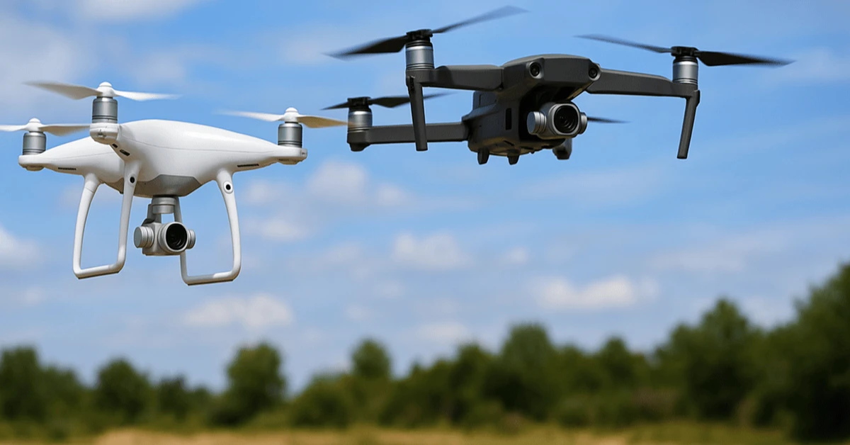
Overview: Over the last two years Pakistan has seen a rapid expansion in drone use for disaster response — from thermal-imaging scouting flights to experimental airlift drones and medical-supply deliveries. This article explains current deployments, real-world case studies from recent floods, technical options, regulatory and operational barriers, and a pragmatic roadmap for scaling drone usage in Pakistani disaster relief operations.
Why drones matter for disaster relief in Pakistan
Pakistan is highly vulnerable to sudden-onset disasters (flash floods, cloudbursts, seasonal monsoons, landslides). Drones make it possible to:
- rapidly map inundation and inaccessible areas
- locate stranded people using visual and thermal imaging
- deliver lightweight medical and survival supplies to cut off communities
- support disease-control operations (e.g., targeted larvicide spraying)
Recent deployments and concrete examples
Punjab floods — search & rescue and thermal imaging
During the 2025 Punjab floods, provincial emergency teams and Safe City units deployed thermal and reconnaissance drones to locate stranded residents on rooftops and guide rescue boats and helicopters. Authorities reported hundreds of rescues directly supported by drone surveillance during peak operations. 0
Emergency airlift drones
In 2025, provincial authorities trialled — and in some cases announced — airlift/ cargo drone capability intended to carry heavier loads and assist in delivering packaged aid where roads were washed out. These early systems are a mix of domestic procurement and equipment showcased by public safety units. 1
Flying Labs and NGO / UN pilots
Organizations such as Flying Labs and UN partners (including UNICEF pilots focused on public-health uses) have worked on mapping, disease-prevention pilots, and last-mile-aid concepts in Pakistan — leveraging local partners to train operators and test use cases like larvicide application and health-supply delivery. 2
Research & proof-of-concept work
Academic and technical teams have modeled drone-based distributions for health kits and emergency medicines in flood-affected areas, showing potential for time savings and faster initial response in constrained settings. 3
What works well (strengths of drones in this context)
- Speed: Drones can survey large areas in hours that would take ground teams days.
- Access: They reach cut-off villages where roads are gone or bridges collapsed.
- Low cost per sortie: Small drones are relatively inexpensive to operate versus helicopters.
- Precision: Thermal sensors and high-resolution cameras improve victim detection, especially at night.
Limitations and risks
Despite clear benefits, drone use faces important constraints:
- Payload limits: Most drones can't carry heavy evacuation loads — airlift drones are still nascent and limited in number.
- Range and endurance: Battery life limits flight time; long-range operations need BVLOS (beyond visual line of sight) approvals and infrastructure.
- Regulation & airspace coordination: Disaster zones also have helicopters, military flights, and manned aircraft — safe integration is crucial.
- Technical capacity: Local operators need training in flight ops, data processing, and mission planning.
- Security concerns: Adversarial misuse (weaponised drones) is an evolving risk in Pakistan’s security environment and affects permissions and public perception. 4
Operational model: How to deploy drones in a flood emergency
A practical operational sequence that many pilots follow:
- Rapid mapping: First 6–24 hours — fly reconnaissance grid to map inundation and identify priority villages.
- Thermal sweeps: Night flights with thermal cameras to find stranded people and livestock.
- Communications relay: Use drones to drop small radios or relay messages to isolated pockets.
- Last-mile delivery: Deliver medical kits, ORS, and life-jackets by parachute or precision drop in locations that are otherwise unreachable.
- Assessment & planning: Provide damage assessment and GIS layers to planners for camp placement and relief logistics.
Technology options and procurement checklist
Key choices organizations must make when procuring drone capability:
- Platform type: Multirotor for precision and hovering (search & rescue), fixed-wing for large-area mapping, VTOL hybrid for range + vertical landing.
- Sensor suite: RGB cameras, thermal imaging, LiDAR (for detailed mapping where needed), and drop-release mechanisms for payloads.
- Command & control: Ground-control stations with mission planning and geofencing.
- Data processing: On-the-fly orthomosaic generation, automated change detection, and exportable GIS layers.
- Maintenance & spares: Batteries, rotors, spare motors, and trained technicians — especially important in humid, dusty flood environments.
Regulation, permissions & safety
To scale drones responsibly in Pakistan you need:
- clear emergency protocols for temporarily fast-tracking BVLOS and humanitarian flight approvals;
- airspace deconfliction plans with defense and civil aviation;
- data-privacy policies for imagery collected over private property;
- community engagement plans so affected people understand drone missions and safety.
Case study: How thermal drones supported rescues in Punjab (2025)
During the 2025 Punjab floods, Safe City and provincial teams used thermal and reconnaissance drones to find people on rooftops and help coordinate boats and ground teams. Officials and press reported that drone imagery directly supported hundreds of rescue actions and faster relief targeting — an example of drones augmenting, not replacing, traditional search and rescue assets. 5
Cost & funding models
Possible funding models for sustainable drone capabilities:
- public procurement by provincial disaster management authorities;
- NGO + UN cost-sharing programs for pilots and training;
- public-private partnerships where telecom or logistics firms provide infrastructure;
- community-owned drone hubs supported by municipal funds or donor grants.
Roadmap: 7 steps to scale drone-based disaster response in Pakistan
- Pilot & evaluate: Run structured pilots across provinces focusing on mapping, thermal search, and small payload delivery; collect performance metrics.
- Standardize protocols: Create SOPs for mission types (search, delivery, mapping) and airspace coordination templates for emergencies.
- Build regional hubs: Establish drone hubs in at least one city per province with trained pilots, spares, and maintenance capacity.
- Data-sharing platform: Implement a cloud GIS portal for relief agencies to access drone maps and overlays in near-real time.
- Training programs: Partner with local universities, Flying Labs, and vocational institutes to certify operators and analysts. 6
- Regulatory sandbox: Civil aviation + defense should create an emergency-use sandbox enabling temporary BVLOS and priority airspace during declared disasters.
- Community & security safeguards: Clear rules on imagery retention, public briefings, and risk mitigation against weaponization concerns. 7
Metrics to track success
Use these KPIs to evaluate effectiveness:
- time from disaster onset to first drone mission
- number of people located or assisted via drone guidance
- area (km²) mapped within first 48 hours
- average time to deliver a small medical kit vs ground methods
- reduction in response time for downstream relief assets
Practical checklist for an NGO or district team starting tomorrow
- identify 1–2 small multirotor systems with thermal cameras and spares
- train 4–6 operators (rotating shifts) and 2 data analysts
- prepare a mission kit (batteries, chargers, spare props, laptop with mission software)
- establish lines with local civil aviation and defense for emergency flights
- run tabletop exercises once a quarter
Ethics and community engagement
The public must be informed about why drones operate, what data they collect, and how imagery will be used. Respect for privacy, clear data retention schedules, and channels for community questions are essential to preserve trust during emergency operations.
Conclusion
Drones are not a silver bullet, but they are already proving to be a powerful force multiplier in Pakistan’s disaster response toolbox. With focused investment in hubs, standardized protocols, community safeguards, and a regulatory emergency sandbox, Pakistan can scale drone usage responsibly and save many more lives in future disasters. Recent flood responses have shown the promise — now it's time for system-level thinking to turn pilots into sustained capability. 8
Frequently Asked Questions (FAQs)
Q: Can drones evacuate people?
A: Most small drones cannot carry humans. Some large prototype airlift drones are being trialed for cargo and very limited rescue tasks, but full human evacuation currently depends on boats, helicopters and ground teams. Airlift drones are useful for moving supplies and sometimes light-load extractions in extreme cases. 9
Q: Are drones safe to fly over disaster zones with helicopters and military aircraft?
A: Only with coordinated airspace management and clear communication channels. Disaster-operation protocols must include temporary airspace deconfliction and a single command authority to avoid collisions.
Q: How much does a useful SAR (search & rescue) drone setup cost?
A: A competent multirotor with thermal camera, spares, and ground station can range from a few thousand to tens of thousands of USD depending on sensors and redundancy. Fixed-wing or airlift systems scale higher. Operational costs include batteries, training, and maintenance.
Q: Can drones help prevent disease outbreaks after floods?
A: Yes — drones have been used for mapping standing water, mosquito-larvicide application pilots, and rapid delivery of health supplies to clinics. These uses were part of UN and NGO pilots in Pakistan. 10
Q: What legal permissions are needed to fly drones in Pakistan for humanitarian work?
A: Humanitarian drone operators should coordinate with Pakistan Civil Aviation Authority (PCAA), local defense/airspace authorities, and provincial disaster management authorities, especially for BVLOS flights and operations near populated areas. Emergency protocols can expedite approvals during declared disasters.
Note: This article references recent deployments and reporting from national and international news outlets and humanitarian organizations to provide an up-to-date picture of how drones are being used in Pakistan’s disaster response landscape.
You May Also Like:
Low-Cost Drones Made in Pakistan: A New Era for Smart Agriculture...
Pakistani Monsoon Flood Crisis 2025: Current Impact, What to Expect & How to Stay Safe...
Dengue Outbreak 2025: Will Cold Weather in December-January Bring Relief?...

PCB’s 2025-26 Women’s Cricket Calendar: A Game-Changing Move for Pakistan Women’s Cricket...

Biological Sex Testing & Trans Athlete Ban: How Women’s Sports Policies Are Rapidly Changing in 20...

Disappearing Digital Payments in Pakistan: Why Transfer Amounts Get Lost Between Banks, Wallets and ...

Extreme Heat and Hailstorms: What's Happening and Why?...
